Sem 06 | Settlement Studies
Environmental Conditions, Ground, and Built Form - 1
Dipti Bhaindarkar and Sabaa Giradkar
The image of the older city of Mumbai is constructed through the map of seven islands. These islands came together physically with time to form the current landmass of the city. Mumbai has water on three sides forming larger coastlines on the west and the east. Western coast of the city is lined with public water edges whereas the water depth increased towards the eastern edge to accommodate docks and landing points for trade boats. The colonial Bombay was reshaped with construction of major roads and railways during the mid-18th century. This transformed Bombay into a major seaport on the Arabian Sea. The ports on the eastern edge of the city were the preeminent commercial ports of India in the nineteenth and twentieth centuries. Within this 1800 odd-acres, is a mix of activities, defense activities and large and small scale industries, much of which still revolve around the marine business and trade.
To be able to closely study these different existing conditions, the two week study was focused around the Wadala-Sewri Mudflats. The primary objective of this course Environmental Conditions, Ground and Built Form was to understand and foreground the altering ground conditions and the social, economic, cultural infrastructure of interdependencies between the humans as well as the non human life forms.
The trope of drawing maps and diagrams of the ground and terrain have evolved since history. Several cartographic maps were generated in history to document and communicate the sea bed depths, to assign fixed boundaries to land and water, to assign the coast profile, and infrastructure building. Each map thus drawn was towards a specific purpose such as effective administration of the land-water edge, better governance through acts and regulations imposed. This studio began with reading maps through history starting from 1872 to current times. These methods of map making have created a distinct separation line between land and water.
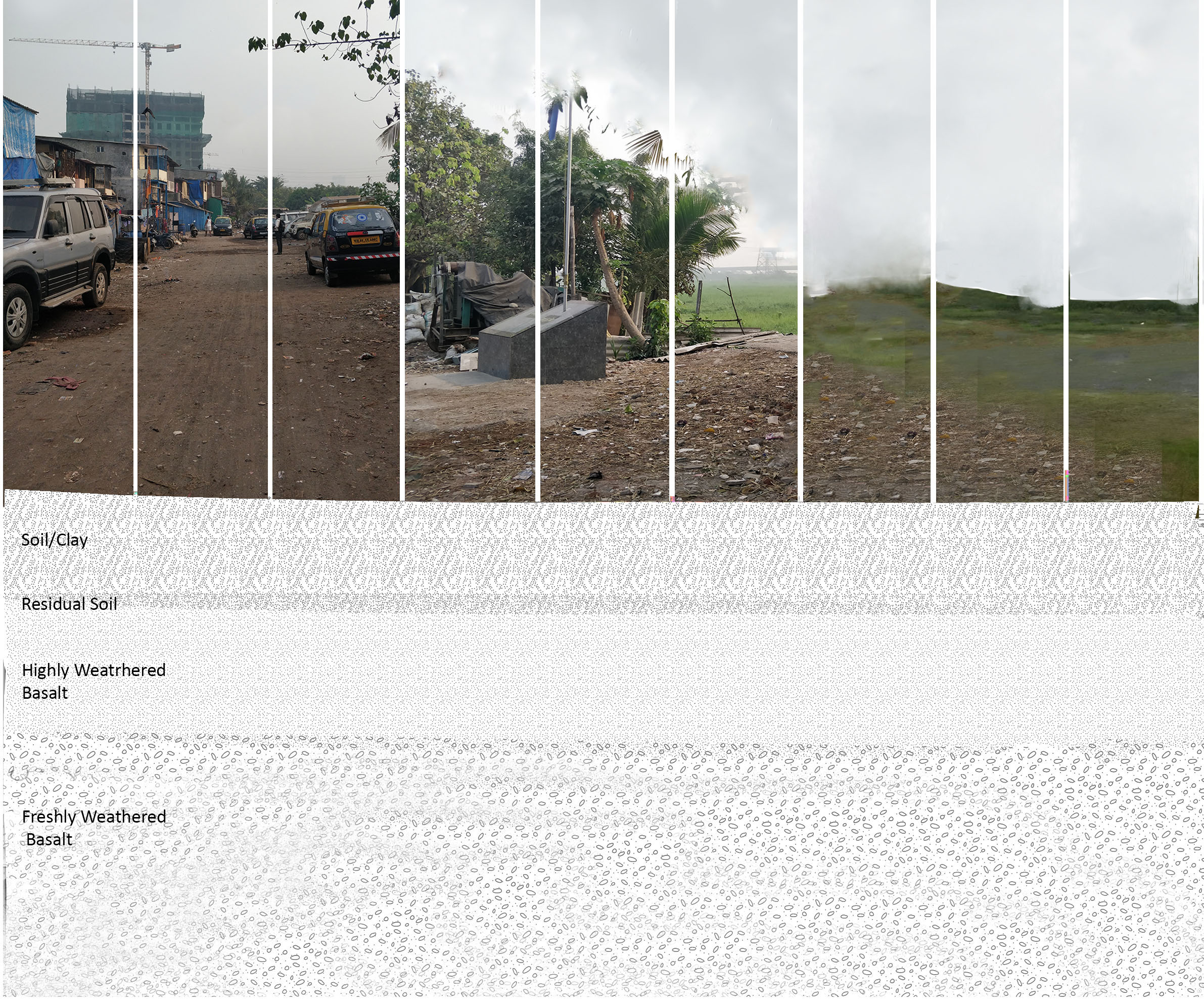
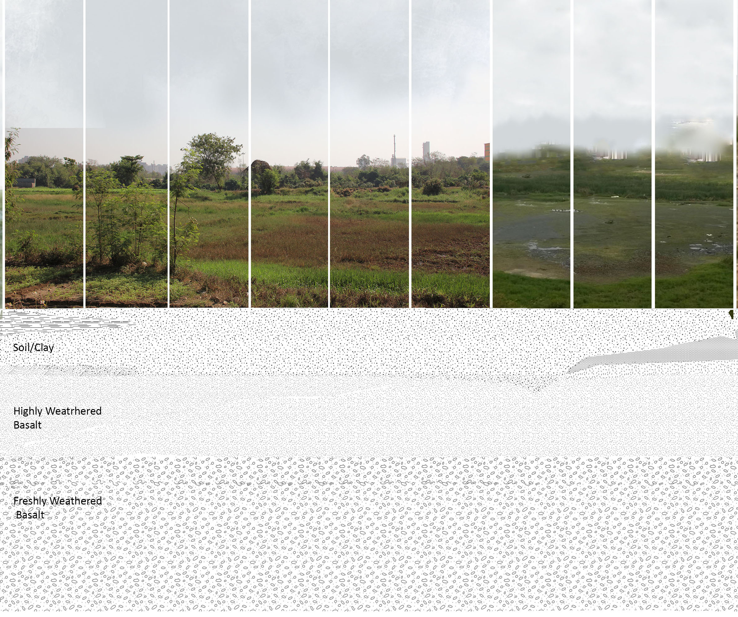
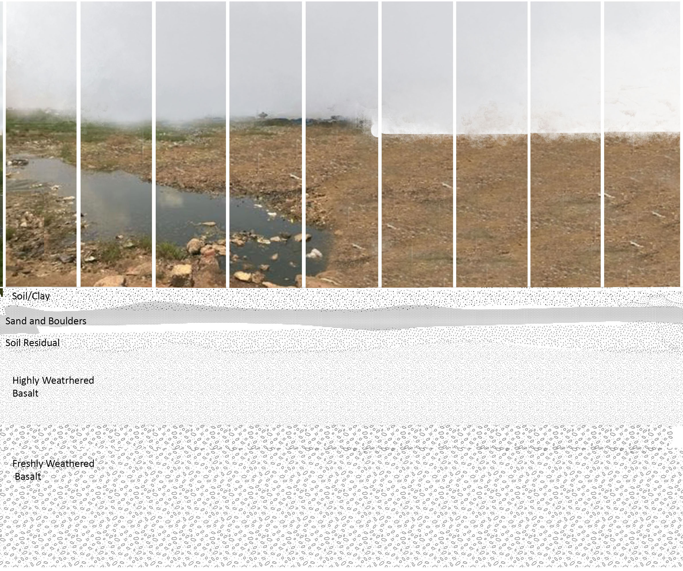
The students understood the act of map making and its relevance in time to further generate their own ideas of constructing maps and drawings to read the ground and terrain emerging from its inherent nature. The study area between the Wadala mudflats and the new trans harbour link was thus reconstructed as a set of interdependencies of land: nature of soil and terrain, supporting vegetation, different built typologies, nature of the ground and activities of water: salinity, tidal cycles, land edge and hence activities, flora and fauna, and air: density, supporting fauna, temperature and humidity currents and socio-cultural and economic activities of human inhabitants. The course built drawings of the ground with an added layer of socio-cultural relationship, economic and regional dependencies. Studying the site through only available secondary data and interaction with a biodiversity expert, an environmental activist and a conservation architect helped students to understand and question the method of studying a place through older maps which were drawn as hard lines to note physical transformations, highlighting the disconnect and inability to hold the dynamic and changing nature of the context.
The two week study concluded with asking questions and became the course learnings as well
The two week study concluded with asking questions and became the course learnings as well
- What is a ground really ? Only a hard surface or an ecological system that holds and supports the subterranean water, soil, air and sky together?
- What can be the vocabulary to be sensitive and better understand the different ecologies and systems that live by and of the ground ?
- Where and how does one draw a single line on the ground to define boundaries of existence when the study at every point suggested the seasonal, social and economical interdependencies between the different stakeholders; human and non human both ?
- How can drawing become an intervention to dissolve the idea of this single line (as understood through cartographic maps) and build the blurred narratives of coexistence and interdependencies?

1879

1969

Present Day