Sem 02 / Settlement Studies
Maps of Mategaon
Apurva Talpade
The village of Mategaon is a small settlement in the Parbani district of Maharashtra, close to the Ellora caves and three hours by a motor road from the city of Aurangabad. Here, the students were organised into six groups and produced a breadth of drawings for a larger picture to emerge on the correlations between the built forms and the economic modes on which the village is reliant.
Maps
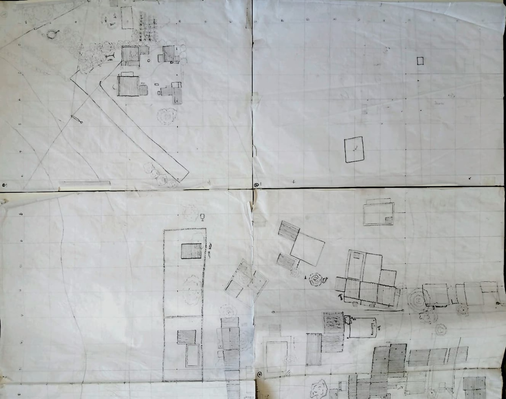
A large drawing to chart the whole of the settlement, marking the road network, the open spaces within the village used for markets and other gatherings, the roofscape indicating the shifts in construction methods, the edges of the house clusters and how they give way to the surrounding fields, the scale and frequency of the religious and other institutions and most importantly, the unclear ways in which boundaries are established between property, public space, field edge and commons through various kinds of claims and practices, made evident in the house extensions, delineations of the clearings for public space, and the encroachment and spillage of our understanding of domestic life and its sphere into community life.
Houses
A survey and drawing of three houses within the village, each located within different communities with its inhabitants having distinct socio-economic positions that play out in the making and structuring of their built spaces. Several threads are drawn out from here and the village reveals itself more plainly through this study - the blurry but calcifying lines between the Hindu and Muslim communities, it’s Dalit community present but with a tentative hold on its land at the periphery of the village, the levels of the consolidations of the house forms and their relationship to caste-class aspect of the residents, the aspirations of the people, their routines and how the house accommodates them, etc.
Culture
A pursuit of the everyday markers that draw out a sense of the objects and organisations that describe and stake out the particularities of living in Mategaon. It was drawn in detailed elevations of two street fronts, with drawn notes on the lives being lived on the thresholds of the houses; in thorough and exhaustive drawings of three kitchens that took note not just of the items and their arrangement within the physical dimensions of the space but also the reach of the kitchen and therefore its expanse and importance in the house; and an opened up drawing of a house that elucidates the layered way in which the house grows and shifts - through the accrual of old wooden brackets with new steel bolts, esoteric furniture collections,
Institutions
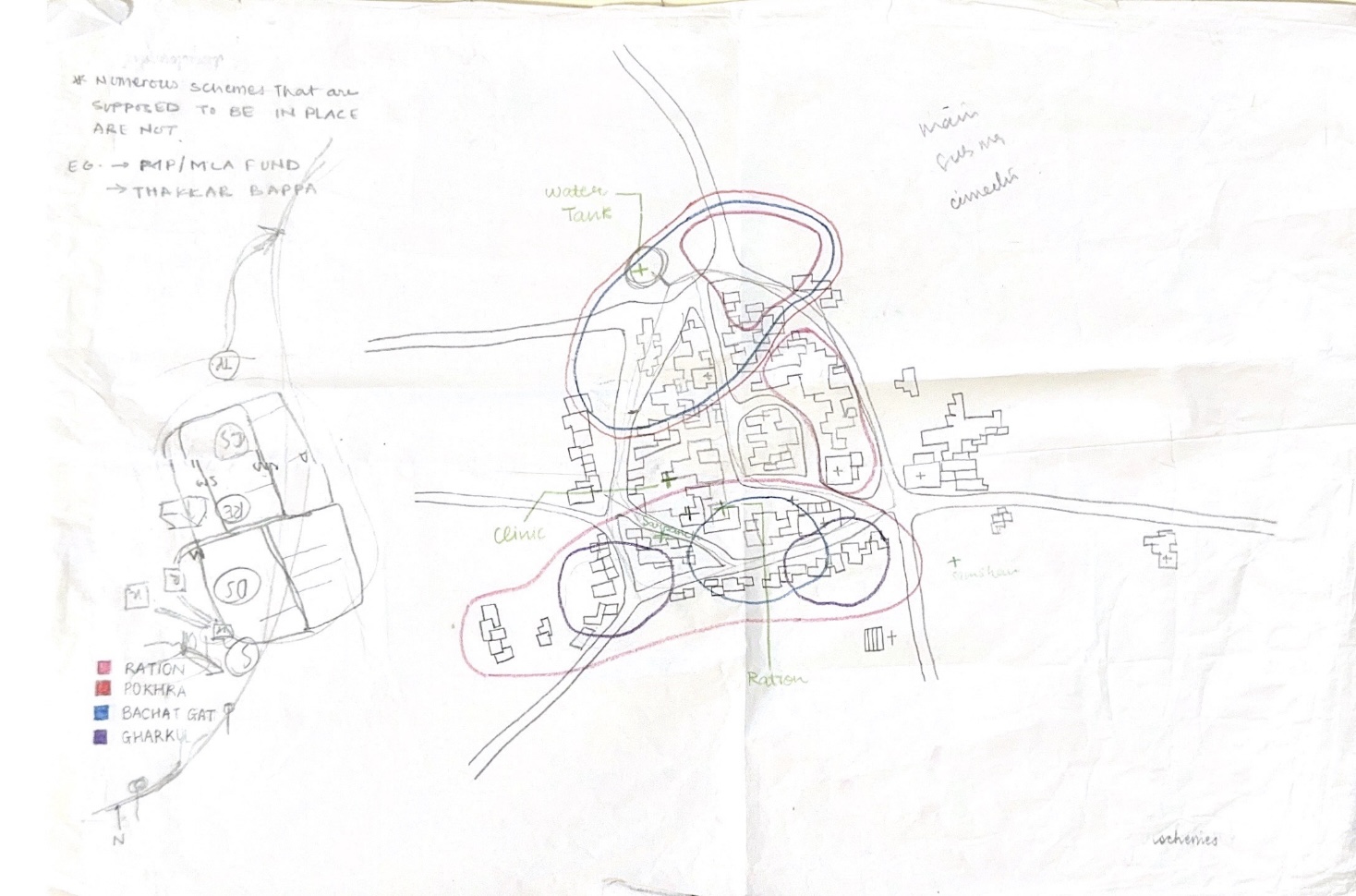
The Buddha vihar, the Datta mandir, the Hanuman mandir, the Tukaram mandir, the masjid, the smashan bhumi, the school and the balvadi, the local dispensary, the composition of the Gram Panchayat, the distribution of communities across the village, the linkages of these to the beneficiaries of the many schemes brought in and to the distribution of the land owners and daily wage labourers - the positions of these institutions and institutionally dictated configurations was mapped in the form of descriptive and quantitative research constituting long notes, sketches and diagrams, and photographs from observations and oral histories.
Economy
A calendar that folds in the cycles of production of the various crops that the village is engaged in growing by drawing their specific routines with a focus on the specialised practices of each. It compresses time and space, the year is read not through the metre of months, but through the aggregates of the many systems of ploughing, sowing, fertilising and harvesting corn, millets, wheat, cotton and sugarcane that overlap and intersect and mark the year as a collection of the habits and the ordering of life of the agriculturist.
Region
Locating the village within the larger geography of the landscape by mapping the expanse of the surrounding fields, its proximity to significant actors in the region like the river and the dam, the factory that processes certain crops, significant water sources, and major and minor roads. The intent of the drawing here is also to simply reveal how the terrain of the region is constituted of specific features that may appear inconsequential (builtform, landform, markers), but have a deep, significant and enduring influence over the existence and survival of the village.

A regional map
![]() Mapping the distribution of microfinance schemes
Mapping the distribution of microfinance schemes
![]()
Mapping the distribution of landowners and daily wage workers
![]() A street elevation
A street elevation
![]()
![]() Fieldwork notes
Fieldwork notes
 Mapping the distribution of microfinance schemes
Mapping the distribution of landowners and daily wage workers
 A street elevation
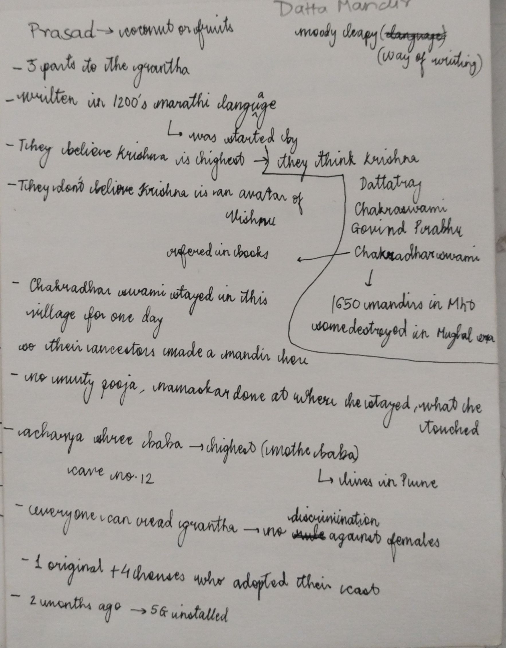
 Fieldwork notes
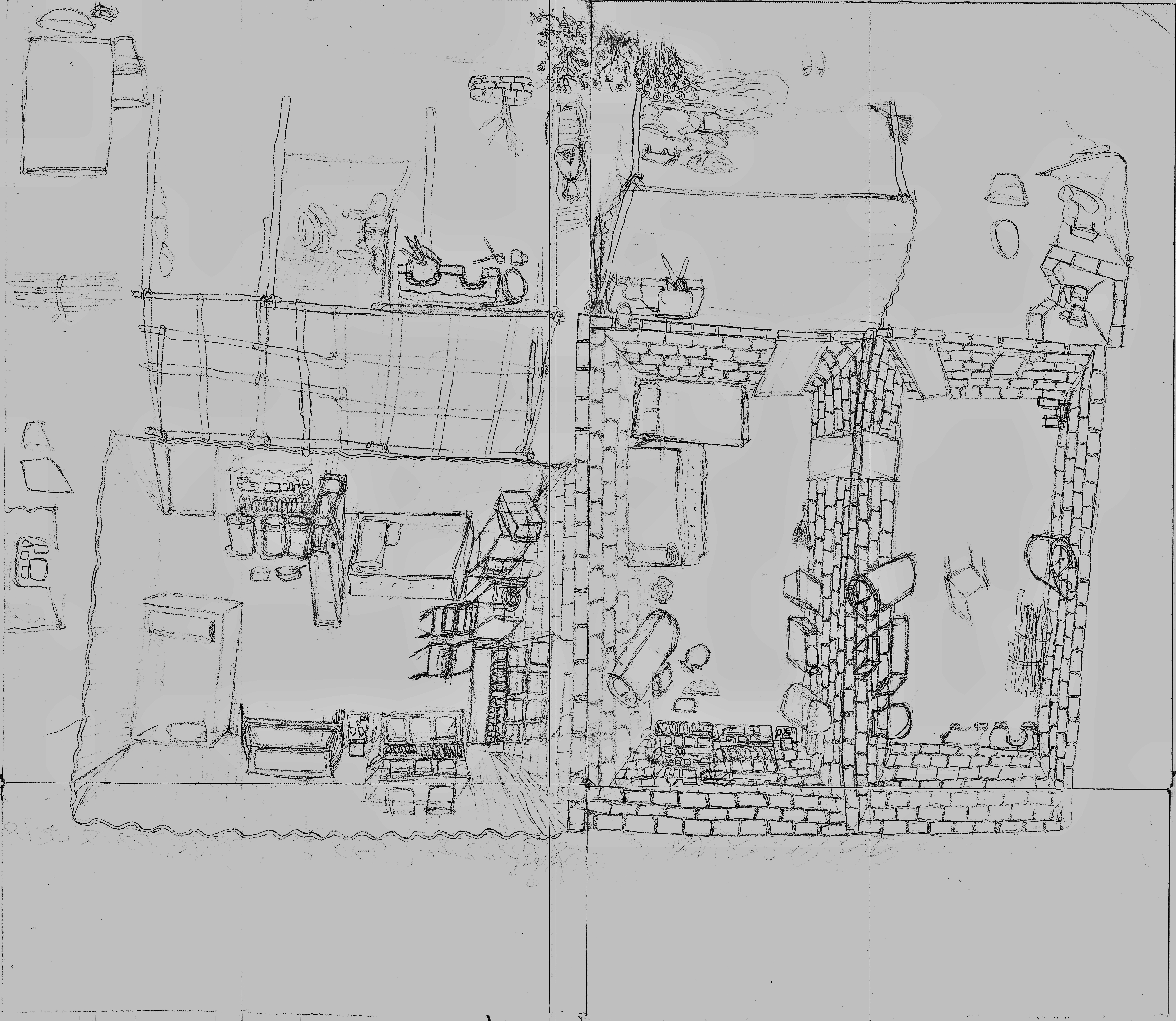

Study of a house along the village edge
![]()
![]()
Mapping the village
![]()
![]()
![]() Significant institutions
Significant institutions
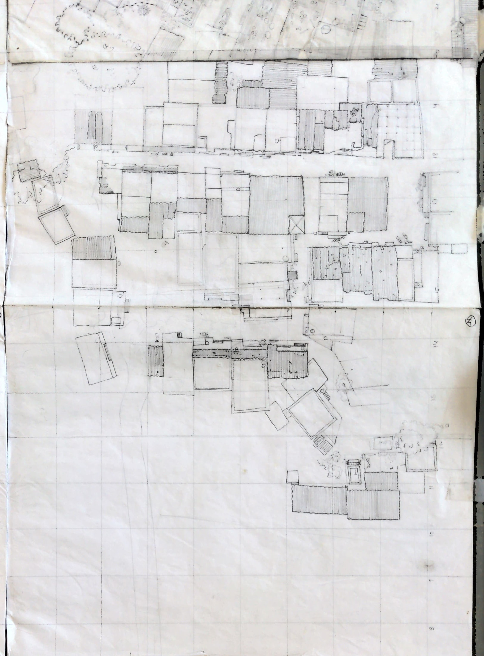
Mapping the village


 Significant institutions